A recent study has cast a spotlight on the dynamic tectonic landscape of the Moon’s south pole, revealing a series of lobate thrust fault scarps indicative of ongoing seismic activity. Notably, the de Gerlache Rim 2 region, a candidate landing site for the Artemis III mission, is home to a cluster of these scarps, underscoring the need for cautious planning for future lunar missions.
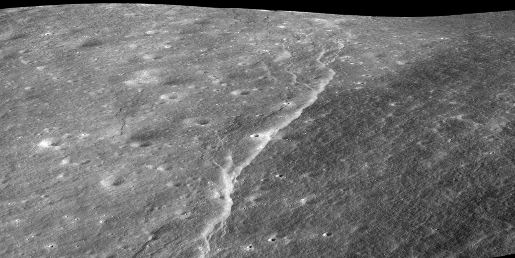
A lobate thrust scarp is a type of geological feature commonly found on planetary surfaces, including the Moon and Mercury. It’s essentially a cliff or steep slope (the scarp) formed by the movement of crustal materials along a thrust fault, which is a break in the planetary body’s crust.
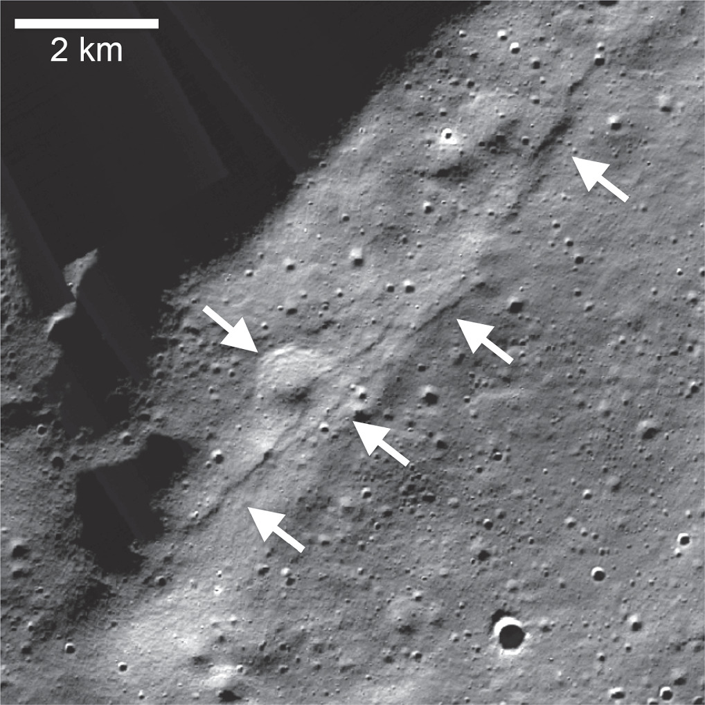
Researchers have discovered that the largest scarp in the de Gerlache area, located a mere 60 km from the lunar south pole, may have been the epicenter of one of the most intense shallow moonquakes ever recorded by the Apollo Passive Seismic Network. A seismic event with a magnitude of approximately 5.3 is theorized to have resulted in the formation of this lobate thrust fault scarp. Modeling predicts that such a quake could generate strong to moderate ground shaking up to a distance of 40 km, and moderate to light shaking beyond that.
This revelation is of paramount importance for lunar exploration and potential plans for long-term human presence on the surface. The steep slopes of the Shackleton crater, situated in the south polar region, are particularly prone to regolith landslides, which could be triggered even by light seismic shaking. This poses a significant risk, especially if the lunar regolith has low cohesion.

The survey, utilizing high-resolution images from the Lunar Reconnaissance Orbiter Camera (LROC), has identified 15 known and newly detected lobate scarps within 150 km of the south pole. These features, characterized by their linear to arcuate shapes and asymmetric cross sections, are considered among the youngest landforms on the Moon. Their widespread presence across the lunar surface, including the south pole, underscores the influence of global compressional stresses leading to tectonic deformation.
The newfound understanding of the seismic landscape of the lunar south pole carries important implications. It emphasizes the need for meticulous consideration of potential seismic events when planning permanent structures or missions, highlighting the delicate balance between lunar exploration and the inherent risks of our nearest planetary neighbor.
Source: R, Watters T, et al. “Tectonics and Seismicity of the Lunar South Polar Region.” The Planetary Science Journal, vol. 5, no. 1, 2024, p. 22, dx.doi.org/10.3847/PSJ/ad1332, https://doi.org/10.3847/PSJ/ad1332.
Featured Image: NASA/GSFC/Arizona State University